The study region for our off-shore experiment covers the area between the Azores archipelago in the west, to Madeira and the Canary Islands to the east. This is an under-studied natural laboratory comprising significant mantle upwellings that are poorly understood in general. The map below shows the approximate route we took over approximately 35 days in the summer of 2021.
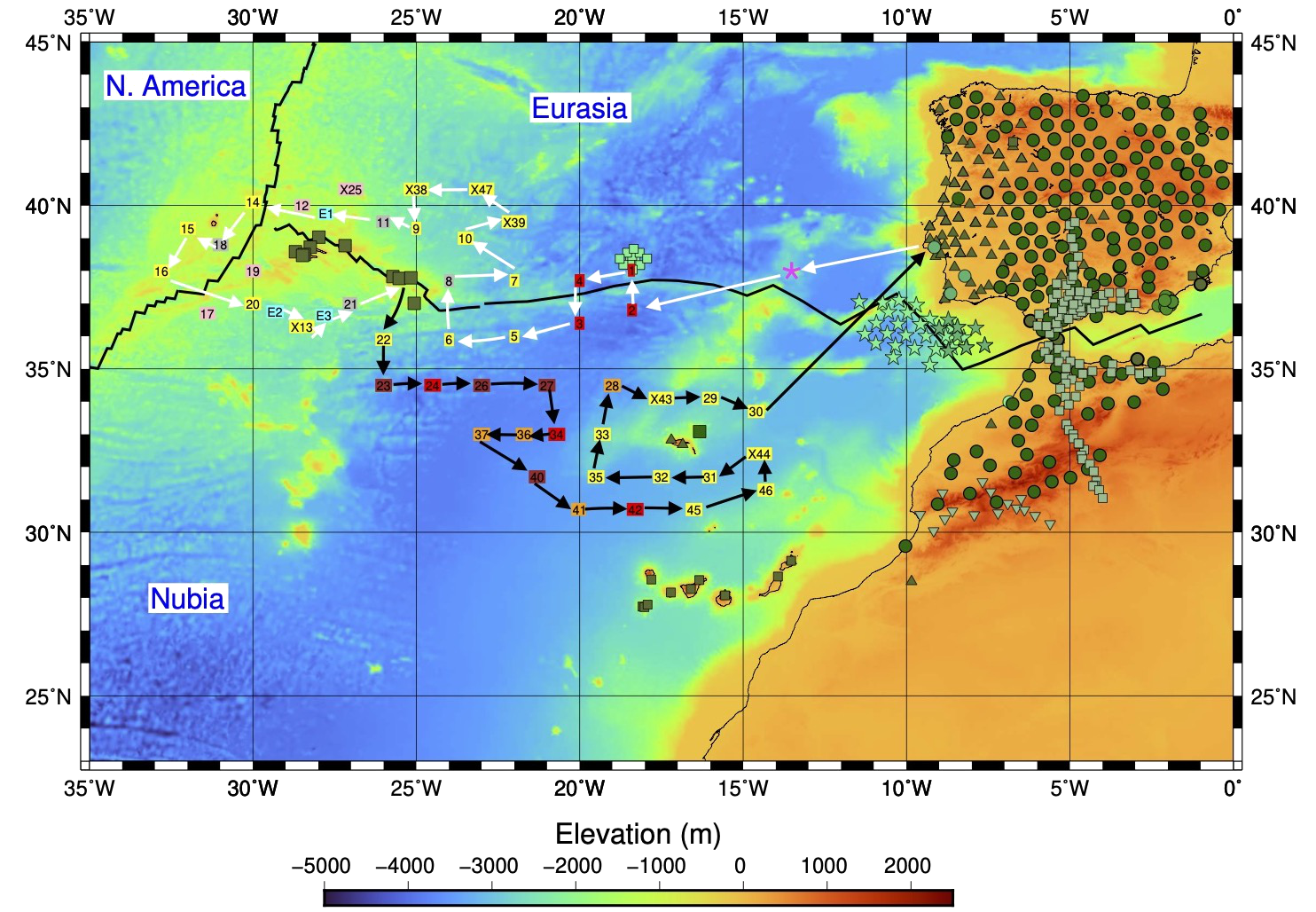
Route of the UPFLOW deployment. The first leg is represented by white arrows (departure from Lisbon on the 14th of July and arrival to Ponta Delgada within the period of 28 July – 1 August). The second leg is represented by black arrows (departure from Ponta Delgada sometime between the 30th of July and 2nd of August) and arrival to Lisbon on the 17th of August. The magenta star indicates the approximate location where the releasers were tested. Instruments from different pools are represented by different colours (DEPAS: Yellow (LOBSTER), brown (LOBSTER-new tube), orange (NAMMU); DIAS: red ; IDL: grey; GEOMAR: light pink; ROA: cyan). Different shades of green stars, circles, squares and triangles correspond to existing/previous stations.